
Tumana Park topographic map
Interactive map
Click on the map to display elevation.
About this map
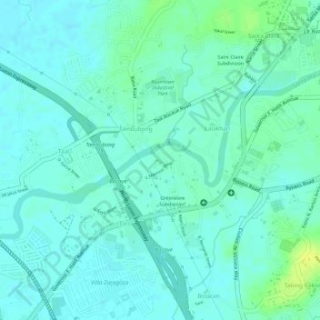
Name: Tumana Park topographic map, elevation, terrain.
Location: Tumana Park, Tambubong, Bulacan, Central Luzon, Philippines (14.81201 120.94132 14.81237 120.94175)
Average elevation: 8 m
Minimum elevation: 2 m
Maximum elevation: 21 m
Other topographic maps
Click on a map to view its topography, its elevation and its terrain.
Tambubong
Philippines > Bulacan > Tambubong
Tambubong, Bulacan, Central Luzon, 3014, Philippines
Average elevation: 8 m