
Jones County topographic map
Interactive map
Click on the map to display elevation.
About this map
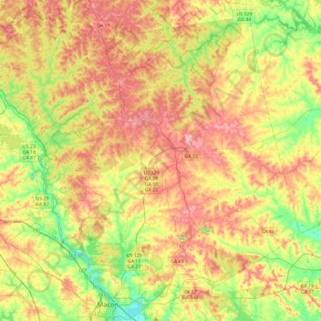
Name: Jones County topographic map, elevation, terrain.
Location: Jones County, Georgia, USA (32.84129 -83.81653 33.18584 -83.35769)
Average elevation: 145 m
Minimum elevation: 81 m
Maximum elevation: 212 m
Other topographic maps
Click on a map to view its topography, its elevation and its terrain.
Ferrell Crossroads
USA > Georgia > Ferrell Crossroads
Ferrell Crossroads, Early County, Georgia, USA
Average elevation: 94 m
Cameron Point
USA > Georgia > Cameron Point
Cameron Point, Hall County, Georgia, 30506:30534, USA
Average elevation: 339 m