
Sto. Tomas topographic map
Interactive map
Click on the map to display elevation.
About this map
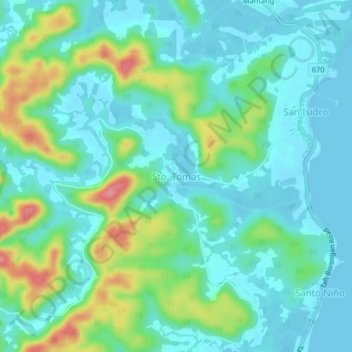
Name: Sto. Tomas topographic map, elevation, terrain.
Location: Sto. Tomas, Eastern Samar, Eastern Visayas, Philippines (11.82954 125.39992 11.86954 125.43992)
Average elevation: 25 m
Minimum elevation: 0 m
Maximum elevation: 99 m