
Lào Cai topographic map
Interactive map
Click on the map to display elevation.
About this map
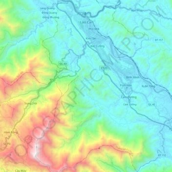
Name: Lào Cai topographic map, elevation, terrain.
Location: Lào Cai, Lao Cai province, Vietnam (22.31002 103.89662 22.52635 104.06324)
Average elevation: 480 m
Minimum elevation: 63 m
Maximum elevation: 2,360 m
Other topographic maps
Click on a map to view its topography, its elevation and its terrain.
Fansipan
Vietnam > Lao Cai province > Sa Pa > Hoang Lien Commune
Fansipan, Hoang Lien Commune, Sa Pa, Lào Cai Province, Vietnam
Average elevation: 2,616 m
Sa Pa District
Sa Pa District, Lao Cai province, Vietnam
Average elevation: 1,276 m