
Tielve topographic map
Interactive map
Click on the map to display elevation.
About this map
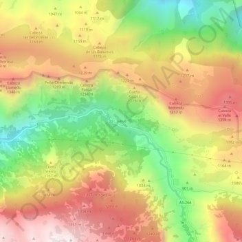
Name: Tielve topographic map, elevation, terrain.
Location: Tielve, Asturias, Spain (43.24325 -4.79558 43.28325 -4.75558)
Average elevation: 1,025 m
Minimum elevation: 422 m
Maximum elevation: 1,589 m