
Tinjan topographic map
Interactive map
Click on the map to display elevation.
About this map
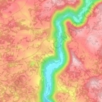
Name: Tinjan topographic map, elevation, terrain.
Location: Tinjan, Općina Tinjan, Istria County, 52444, Croatia (45.19773 13.82075 45.23773 13.86075)
Average elevation: 315 m
Minimum elevation: 183 m
Maximum elevation: 376 m