
Pur Chaman topographic map
Interactive map
Click on the map to display elevation.
About this map
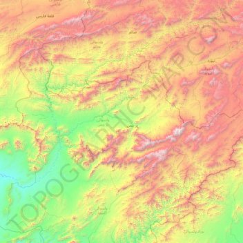
Name: Pur Chaman topographic map, elevation, terrain.
Location: Pur Chaman, Farah Province, Afghanistan (32.73202 63.04231 33.59153 64.74682)
Average elevation: 2,050 m
Minimum elevation: 895 m
Maximum elevation: 4,067 m