
Eibenstock topographic map
Interactive map
Click on the map to display elevation.
About this map
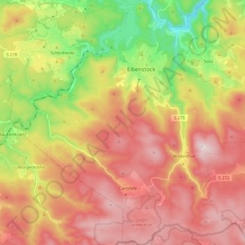
Name: Eibenstock topographic map, elevation, terrain.
Location: Eibenstock, Erzgebirgskreis, Saksen, Duitsland (50.40560 12.49587 50.53945 12.66706)
Average elevation: 743 m
Minimum elevation: 439 m
Maximum elevation: 1,015 m