
Préfecture de Shimane topographic map
Interactive map
Click on the map to display elevation.
About this map
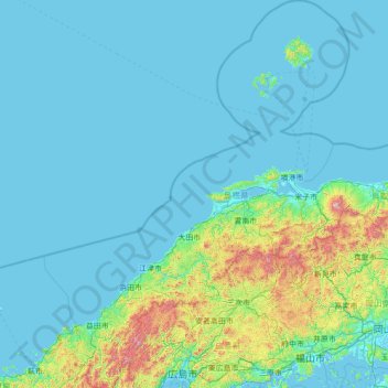
Name: Préfecture de Shimane topographic map, elevation, terrain.
Location: Préfecture de Shimane, Japon (34.30244 131.46194 36.55577 133.63844)
Average elevation: 123 m
Minimum elevation: -5 m
Maximum elevation: 1,573 m
Other topographic maps
Click on a map to view its topography, its elevation and its terrain.