
Hoverla topographic map
Interactive map
Click on the map to display elevation.
About this map
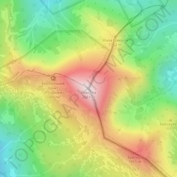
Name: Hoverla topographic map, elevation, terrain.
Average elevation: 1,667 m
Minimum elevation: 1,352 m
Maximum elevation: 2,052 m
In the 20th century, the mountain increasingly gained popularity as an extreme sports site. Some routes are classified as 1A in the winter period (from late autumn to May), according to the Soviet grading system. The most popular approach to the summit starts from the tour-basa Zaroslyak on the mountain's eastern face and gains more than 1,100 m (3,600 ft) elevation along a steep path with few hairpin turns. There is a steeper route (marked with blue signs) and a gentler, longer one (marked with green).