
Sierra Blanca topographic map
Interactive map
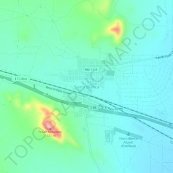
Click on the map to display elevation.
About this map
Name: Sierra Blanca topographic map, elevation, terrain.
Average elevation: 1,391 m
Minimum elevation: 1,355 m
Maximum elevation: 1,542 m
Sierra Blanca is found in Far West Texas, a subdivision of West Texas, and is located at 31°10′55″N 105°20′27″W / 31.18194°N 105.34083°W / 31.18194; -105.34083 (31.182009, -105.340843) 4,520 feet (1,380 m) above sea level. The town is part of the Trans-Pecos region within the most mountainous and arid portion of Texas. The town is located in Hudspeth County, which is large and sparsely populated. Sierra Blanca (White Mountain), at an elevation over 7,000 feet (2,100 m) above sea level, towers over the town to the northwest and is the most prominent mountain peak of the surrounding mountainous terrain.
Other topographic maps
Click on a map to view its topography, its elevation and its terrain.
Dell City
United States > Texas > Hudspeth County > Dell City > Dell City
Dell City, Hudspeth County, Texas, 79837, United States
Average elevation: 1,130 m
Dell City
United States > Texas > Hudspeth County
Dell City, Hudspeth County, Texas, United States
Average elevation: 1,129 m
Salt Flat
United States > Texas > Hudspeth County
Salt Flat, Hudspeth County, Texas, United States
Average elevation: 1,133 m
Fort Hancock
United States > Texas > Hudspeth County
Fort Hancock, Hudspeth County, Texas, 79839, United States
Average elevation: 1,094 m