
Bacungan topographic map
Interactive map
Click on the map to display elevation.
About this map
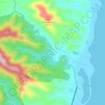
Name: Bacungan topographic map, elevation, terrain.
Location: Bacungan, Puerto Princesa, Mimaropa, Philippines (9.84503 118.70958 9.88503 118.74958)
Average elevation: 82 m
Minimum elevation: 0 m
Maximum elevation: 311 m
Other topographic maps
Click on a map to view its topography, its elevation and its terrain.
Nagtabon Beach
Philippines > Mimaropa > Bacungan
Nagtabon Beach, Bacungan-Nagtabon Rd, Bacungan, Puerto Princesa, Mimaropa, Philippines
Average elevation: 67 m