
Bistrița-Năsăud topographic map
Interactive map
Click on the map to display elevation.
About this map
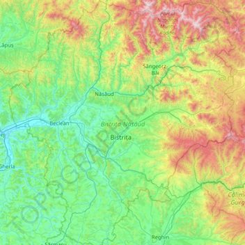
Name: Bistrița-Năsăud topographic map, elevation, terrain.
Location: Bistrița-Năsăud, Romania (46.75085 23.92300 47.60954 25.09096)
Average elevation: 688 m
Minimum elevation: 232 m
Maximum elevation: 2,232 m