
Dena topographic map
Interactive map
Click on the map to display elevation.
About this map
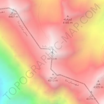
Name: Dena topographic map, elevation, terrain.
Average elevation: 3,893 m
Minimum elevation: 2,746 m
Maximum elevation: 4,415 m
Other topographic maps
Click on a map to view its topography, its elevation and its terrain.
Zagros Mountains
Iran > Isfahan Province > پادناوسطی
Zagros Mountains, پادناوسطی, بخش پادنا, Semirom County, Isfahan Province, Iran
Average elevation: 3,846 m