
Mount Cabalian topographic map
Interactive map
Click on the map to display elevation.
About this map
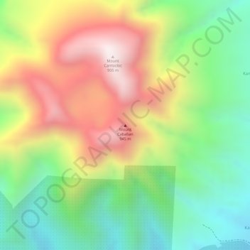
Name: Mount Cabalian topographic map, elevation, terrain.
Average elevation: 524 m
Minimum elevation: 189 m
Maximum elevation: 911 m
Other topographic maps
Click on a map to view its topography, its elevation and its terrain.
Panaon Island
Philippines > Southern Leyte > Maasin
Panaon Island, Maasin, Southern Leyte, Eastern Visayas, 6612, Philippines
Average elevation: 61 m
Maasin
Philippines > Southern Leyte > Maasin
Maasin, Southern Leyte, Eastern Visayas, Philippines
Average elevation: 90 m
San Pablo Island
Philippines > Southern Leyte > Maasin
San Pablo Island, Maasin, Southern Leyte, Eastern Visayas, Philippines
Average elevation: 1 m