
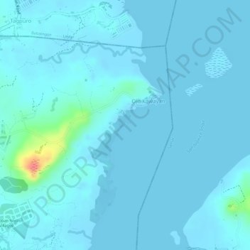
Magsumbul Diutay Island topographic map
Interactive map
Click on the map to display elevation.
About this map
Name: Magsumbul Diutay Island topographic map, elevation, terrain.
Average elevation: 6 m
Minimum elevation: -2 m
Maximum elevation: 71 m
Other topographic maps
Click on a map to view its topography, its elevation and its terrain.
Tacloban
Philippines > Leyte > Tacloban
Tacloban, Leyte, Eastern Visayas, 6500, Philippines
Average elevation: 29 m
Tagpuro
Philippines > Leyte > Tacloban
Tagpuro, Tacloban, Leyte, Eastern Visayas, Philippines
Average elevation: 12 m
Barangay 73
Philippines > Leyte > Tacloban > Barangay 73
Barangay 73, Tacloban, Leyte, Eastern Visayas, 6500, Philippines
Average elevation: 34 m