
The Sandhills topographic map
Interactive map
Click on the map to display elevation.
About this map
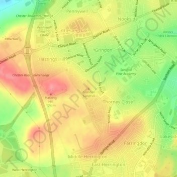
Name: The Sandhills topographic map, elevation, terrain.
Average elevation: 82 m
Minimum elevation: 32 m
Maximum elevation: 118 m
Other topographic maps
Click on a map to view its topography, its elevation and its terrain.
Mowbray Park
United Kingdom > England > Sunderland
Mowbray Park, Ashbrooke, Sunderland, Tyne and Wear, North East England, England, United Kingdom
Average elevation: 26 m