
Beech Forest topographic map
Interactive map
Click on the map to display elevation.
About this map
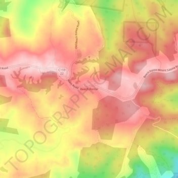
Name: Beech Forest topographic map, elevation, terrain.
Average elevation: 475 m
Minimum elevation: 300 m
Maximum elevation: 564 m
Other topographic maps
Click on a map to view its topography, its elevation and its terrain.
Aire River
Australia > Victoria > Beech Forest
Aire River, Beech Forest, Shire of Colac Otway, Victoria, 3237, Australia
Average elevation: 357 m