
Cleves topographic map
Interactive map
Click on the map to display elevation.
About this map
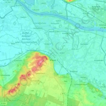
Name: Cleves topographic map, elevation, terrain.
Location: Cleves, Kreis Kleve, North Rhine-Westphalia, 47533, Germany (51.73187 6.03684 51.86545 6.24491)
Average elevation: 24 m
Minimum elevation: 7 m
Maximum elevation: 101 m
Other topographic maps
Click on a map to view its topography, its elevation and its terrain.