
Kaputa topographic map
Interactive map
Click on the map to display elevation.
About this map
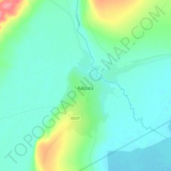
Name: Kaputa topographic map, elevation, terrain.
Location: Kaputa, Province Septentrionale, Zambie (-8.51227 29.62373 -8.43227 29.70373)
Average elevation: 948 m
Minimum elevation: 929 m
Maximum elevation: 1,016 m