
Duisburg topographic map
Interactive map
Click on the map to display elevation.
About this map
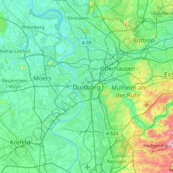
Name: Duisburg topographic map, elevation, terrain.
Location: Duisburg, Noordrijn-Westfalen, 47051, Duitsland (51.27500 6.59956 51.59500 6.91956)
Average elevation: 50 m
Minimum elevation: 12 m
Maximum elevation: 249 m