
Árchez topographic map
Interactive map
Click on the map to display elevation.
About this map
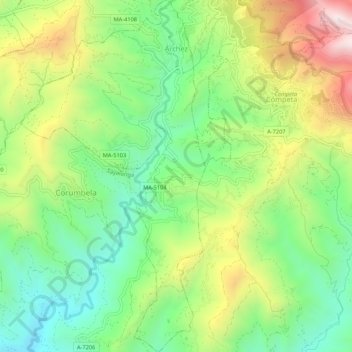
Name: Árchez topographic map, elevation, terrain.
Location: Árchez, La Axarquía, Malaga, Andalusia, Spain (36.80207 -4.01428 36.84484 -3.98627)
Average elevation: 541 m
Minimum elevation: 227 m
Maximum elevation: 1,036 m