
Brea topographic map
Interactive map
Click on the map to display elevation.
About this map
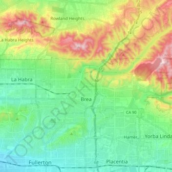
Name: Brea topographic map, elevation, terrain.
Location: Brea, Orange County, California, United States of America (33.90565 -117.92870 33.94763 -117.77744)
Average elevation: 163 m
Minimum elevation: 33 m
Maximum elevation: 440 m