
East Orange topographic map
Interactive map
Click on the map to display elevation.
About this map
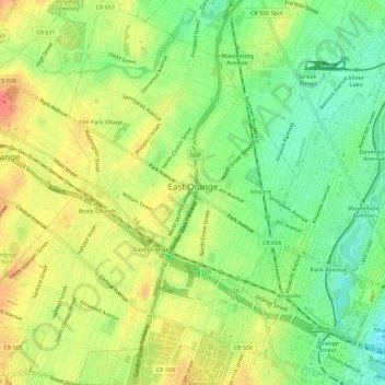
Name: East Orange topographic map, elevation, terrain.
Location: East Orange, Essex County, New Jersey, United States (40.74509 -74.23835 40.78812 -74.18999)
Average elevation: 49 m
Minimum elevation: 20 m
Maximum elevation: 78 m