
Padang topographic map
Interactive map
Click on the map to display elevation.
About this map
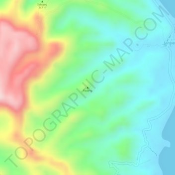
Name: Padang topographic map, elevation, terrain.
Location: Padang, Sabtang, Batanes, Cagayan Valley, 3904, Philippines (20.30333 121.87407 20.30343 121.87417)
Average elevation: 113 m
Minimum elevation: 0 m
Maximum elevation: 310 m
Other topographic maps
Click on a map to view its topography, its elevation and its terrain.
Uyugan
Today's Isantonino farmer still could barely feed his family due to antiquated methods of farming dictated mainly by the topography of the land that at best is unsuitable to agriculture. Nevertheless, Uyugan was a leading producer of beef cattle and garlic prior to the global economy.
Average elevation: 18 m