
Giesteira topographic map
Interactive map
Click on the map to display elevation.
About this map
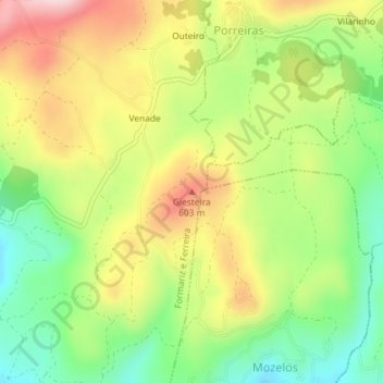
Name: Giesteira topographic map, elevation, terrain.
Average elevation: 492 m
Minimum elevation: 369 m
Maximum elevation: 637 m
Other topographic maps
Click on a map to view its topography, its elevation and its terrain.
Fomariz
Portugal > Norte > Formariz e Ferreira > Fomariz
Fomariz, Formariz e Ferreira, Paredes de Coura, Viana do Castelo, Alto Minho, Norte, Portugal
Average elevation: 405 m