
Benarrabá topographic map
Interactive map
Click on the map to display elevation.
About this map
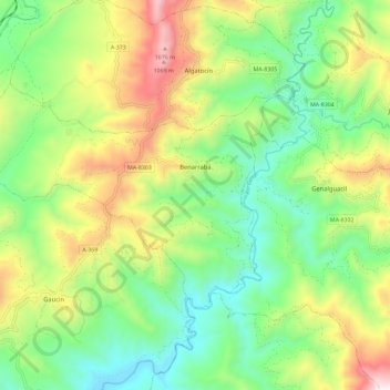
Name: Benarrabá topographic map, elevation, terrain.
Location: Benarrabá, Serranía de Ronda, Malaga, Andalusia, 29491, Spain (36.51697 -5.36868 36.57091 -5.25283)
Average elevation: 482 m
Minimum elevation: 86 m
Maximum elevation: 1,170 m