
Bludenz topographic map
Interactive map
Click on the map to display elevation.
About this map
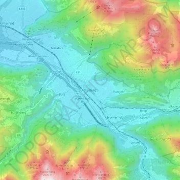
Name: Bludenz topographic map, elevation, terrain.
Location: Bludenz, Bezirk Bludenz, Vorarlberg, 6700, Austria (47.11304 9.78193 47.19304 9.86193)
Average elevation: 988 m
Minimum elevation: 522 m
Maximum elevation: 2,163 m