
Benamocarra topographic map
Interactive map
Click on the map to display elevation.
About this map
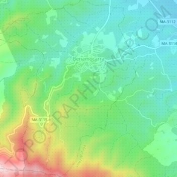
Name: Benamocarra topographic map, elevation, terrain.
Location: Benamocarra, La Axarquía, Malaga, Andalusia, Spain (36.77005 -4.18231 36.80175 -4.15104)
Average elevation: 162 m
Minimum elevation: 35 m
Maximum elevation: 439 m