
Palihan topographic map
Interactive map
Click on the map to display elevation.
About this map
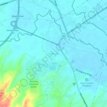
Name: Palihan topographic map, elevation, terrain.
Average elevation: 15 m
Minimum elevation: 5 m
Maximum elevation: 72 m
Other topographic maps
Click on a map to view its topography, its elevation and its terrain.
Maite
Philippines > Bataan > Hermosa
Maite, Hermosa, Bataan, Central Luzon, 2111, Philippines
Average elevation: 63 m