
Hunteburg topographic map
Interactive map
Click on the map to display elevation.
About this map
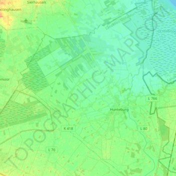
Name: Hunteburg topographic map, elevation, terrain.
Average elevation: 43 m
Minimum elevation: 34 m
Maximum elevation: 62 m
Other topographic maps
Click on a map to view its topography, its elevation and its terrain.
Welplage
Deutschland > Niedersachsen > Landkreis Osnabrück > Bohmte > Hunteburg
Welplage, Hunteburg, Bohmte, Landkreis Osnabrück, Niedersachsen, Deutschland
Average elevation: 44 m