
Ternate topographic map
Interactive map
Click on the map to display elevation.
About this map
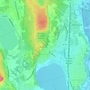
Name: Ternate topographic map, elevation, terrain.
Location: Ternate, Varese, Lombardy, 21020, Italy (45.77253 8.67981 45.79758 8.71569)
Average elevation: 278 m
Minimum elevation: 237 m
Maximum elevation: 402 m
Other topographic maps
Click on a map to view its topography, its elevation and its terrain.