
Kalunasan topographic map
Interactive map
Click on the map to display elevation.
About this map
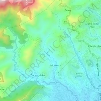
Name: Kalunasan topographic map, elevation, terrain.
Location: Kalunasan, Cebu, Central Visayas, 6000, Philippines (10.32479 123.85779 10.36479 123.89779)
Average elevation: 184 m
Minimum elevation: 40 m
Maximum elevation: 625 m