
Sentosa topographic map
Interactive map
Click on the map to display elevation.
About this map
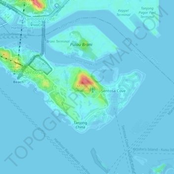
Name: Sentosa topographic map, elevation, terrain.
Location: Sentosa, Southwest, Singapore (1.23780 103.80655 1.26013 103.84841)
Average elevation: 5 m
Minimum elevation: -3 m
Maximum elevation: 75 m
Other topographic maps
Click on a map to view its topography, its elevation and its terrain.