
Wilsonville topographic map
Interactive map
Click on the map to display elevation.
About this map
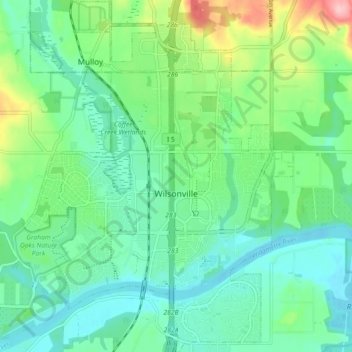
Name: Wilsonville topographic map, elevation, terrain.
Location: Wilsonville, Clackamas County, Oregon, USA (45.28139 -122.80717 45.34469 -122.74290)
Average elevation: 60 m
Minimum elevation: 18 m
Maximum elevation: 181 m