
Changhua County topographic map
Interactive map
Click on the map to display elevation.
About this map
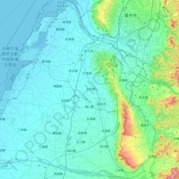
Name: Changhua County topographic map, elevation, terrain.
Location: Changhua County, Taiwan Province, ROC (23.78561 120.24224 24.19739 120.68395)
Average elevation: 75 m
Minimum elevation: -2 m
Maximum elevation: 615 m