
Buford topographic map
Interactive map
Click on the map to display elevation.
About this map
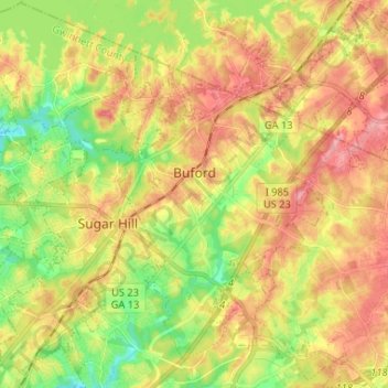
Name: Buford topographic map, elevation, terrain.
Location: Buford, Gwinnett County, Georgia, United States (34.06061 -84.04827 34.16851 -83.93922)
Average elevation: 340 m
Minimum elevation: 285 m
Maximum elevation: 393 m
Buford is located in both northern Gwinnett County in northern Georgia, with a small portion extending north into Hall County. The city is a suburb within the Atlanta metropolitan area. According to the United States Census Bureau, as of 2010 the city has a total land area of 17.09 square miles (44.26 km2), of which 17.01 square miles (44.06 km2) is land and 0.08 square miles (0.20 km2), or 0.44%, is water. The city's elevation is 1,183 feet (361 m).
Other topographic maps
Click on a map to view its topography, its elevation and its terrain.
Sugar Hill
United States > Georgia > Gwinnett County
Sugar Hill, Gwinnett County, Georgia, United States
Average elevation: 332 m