
Limburg an der Lahn topographic map
Interactive map
Click on the map to display elevation.
About this map
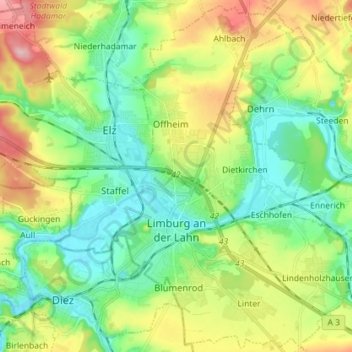
Name: Limburg an der Lahn topographic map, elevation, terrain.
Average elevation: 164 m
Minimum elevation: 105 m
Maximum elevation: 279 m
Other topographic maps
Click on a map to view its topography, its elevation and its terrain.
Linter
Duitsland > Hessen > Landkreis Limburg-Weilburg > Limburg an der Lahn
Linter, Limburg an der Lahn, Landkreis Limburg-Weilburg, Hessen, 65550, Duitsland
Average elevation: 183 m