
Llorente topographic map
Interactive map
Click on the map to display elevation.
About this map
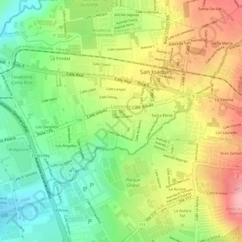
Name: Llorente topographic map, elevation, terrain.
Location: Llorente, Cantón Flores, Provincia Heredia, 40803, Costa Rica (9.99035 -84.17137 10.00419 -84.14909)
Average elevation: 1,025 m
Minimum elevation: 953 m
Maximum elevation: 1,094 m