
Kota Tinggi topographic map
Interactive map
Click on the map to display elevation.
About this map
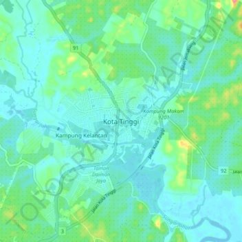
Name: Kota Tinggi topographic map, elevation, terrain.
Location: Kota Tinggi, Johor, Malaysia (1.69314 103.86151 1.77314 103.94151)
Average elevation: 17 m
Minimum elevation: -4 m
Maximum elevation: 74 m