
Horse Island topographic map
Interactive map
Click on the map to display elevation.
About this map
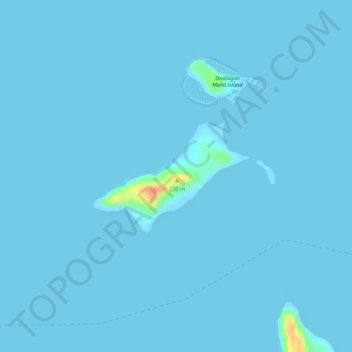
Name: Horse Island topographic map, elevation, terrain.
Location: Horse Island, Busuanga, Palawan, Mimaropa, 5317, Philippines (12.04257 119.89106 12.05116 119.90328)
Average elevation: 1 m
Minimum elevation: -4 m
Maximum elevation: 49 m
Other topographic maps
Click on a map to view its topography, its elevation and its terrain.
San Rafael
Philippines > Palawan > Busuanga
San Rafael, Busuanga, Palawan, Mimaropa, Philippines
Average elevation: 40 m
Banaba River
Philippines > Palawan > Busuanga
Banaba River, Busuanga, Palawan, Mimaropa, 5317, Philippines
Average elevation: 56 m
Dicilingan Island
Philippines > Palawan > Busuanga
Dicilingan Island, Busuanga, Palawan, Mimaropa, 5317, Philippines
Average elevation: 1 m