
Allen County topographic map
Interactive map
Click on the map to display elevation.
About this map
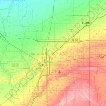
Name: Allen County topographic map, elevation, terrain.
Location: Allen County, Ohio, United States of America (40.64266 -84.39757 40.92043 -83.87984)
Average elevation: 264 m
Minimum elevation: 221 m
Maximum elevation: 336 m
Other topographic maps
Click on a map to view its topography, its elevation and its terrain.
Summit County
United States of America > Ohio
Summit County, Ohio, United States of America
Average elevation: 327 m
Kimbolton
United States of America > Ohio > Kimbolton
Kimbolton, Guernsey County, Ohio, 43749, United States of America
Average elevation: 275 m
Highland County
United States of America > Ohio
Highland County, Ohio, United States of America
Average elevation: 305 m
Ottawa County
United States of America > Ohio
Ottawa County, Ohio, United States of America
Average elevation: 180 m