
Queen Anne's County topographic map
Interactive map
Click on the map to display elevation.
About this map
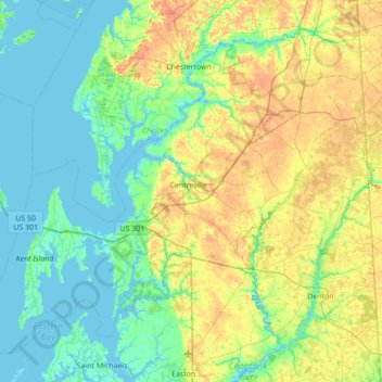
Name: Queen Anne's County topographic map, elevation, terrain.
Location: Queen Anne's County, Maryland, United States of America (38.80345 -76.44188 39.26194 -75.74767)
Average elevation: 10 m
Minimum elevation: -2 m
Maximum elevation: 30 m
Other topographic maps
Click on a map to view its topography, its elevation and its terrain.