
Peniel topographic map
Interactive map
Click on the map to display elevation.
About this map
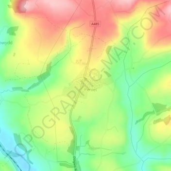
Name: Peniel topographic map, elevation, terrain.
Location: Peniel, Carmarthenshire, Wales, United Kingdom (51.88912 -4.28078 51.89653 -4.26731)
Average elevation: 94 m
Minimum elevation: 15 m
Maximum elevation: 181 m
Other topographic maps
Click on a map to view its topography, its elevation and its terrain.
Peniel
United Kingdom > Wales > Peniel
Peniel, Denbighshire, Wales, LL16 4TD, United Kingdom
Average elevation: 196 m