
Bagamanoc topographic map
Interactive map
Click on the map to display elevation.
About this map
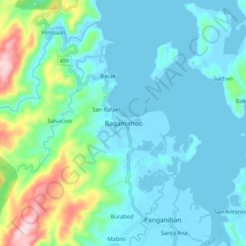
Name: Bagamanoc topographic map, elevation, terrain.
Location: Bagamanoc, Catanduanes, Bicol Region, 4807, Philippines (13.89964 124.24783 13.97964 124.32783)
Average elevation: 64 m
Minimum elevation: -3 m
Maximum elevation: 356 m
Other topographic maps
Click on a map to view its topography, its elevation and its terrain.
Panay Island
Philippines > Catanduanes > Bagamanoc > Suchan
Panay Island, Suchan, Bagamanoc, Catanduanes, Bicol Region, Philippines
Average elevation: 15 m