
Lot topographic map
Interactive map
Click on the map to display elevation.
About this map
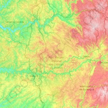
Name: Lot topographic map, elevation, terrain.
Location: Lot, Occitania, Metropolitan France, France (44.20335 0.98123 45.04664 2.21129)
Average elevation: 310 m
Minimum elevation: 59 m
Maximum elevation: 795 m
Other topographic maps
Click on a map to view its topography, its elevation and its terrain.