
Cerro de las Tres Piedras topographic map
Interactive map
Click on the map to display elevation.
About this map
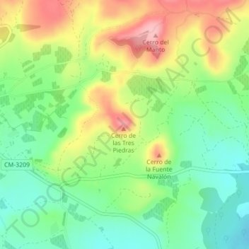
Name: Cerro de las Tres Piedras topographic map, elevation, terrain.
Average elevation: 1,029 m
Minimum elevation: 971 m
Maximum elevation: 1,111 m
Other topographic maps
Click on a map to view its topography, its elevation and its terrain.
Albacete
Spain > Castile-La Mancha > Albacete
Albacete, Castile-La Mancha, 02001, Spain
Average elevation: 717 m