
Mackinac Island topographic map
Interactive map
Click on the map to display elevation.
About this map
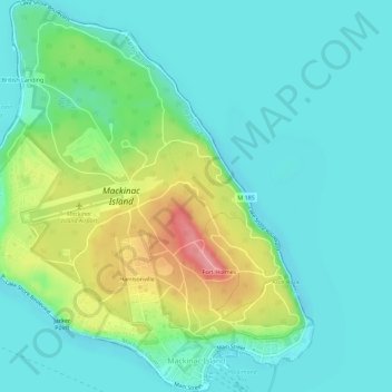
Name: Mackinac Island topographic map, elevation, terrain.
Location: Mackinac Island, Mackinac County, Michigan, 49757, USA (45.84606 -84.65138 45.88545 -84.60240)
Average elevation: 195 m
Minimum elevation: 167 m
Maximum elevation: 269 m