
Mount Riposet topographic map
Interactive map
Click on the map to display elevation.
About this map
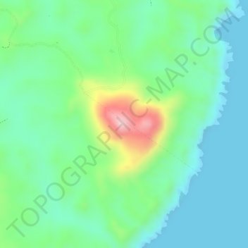
Name: Mount Riposet topographic map, elevation, terrain.
Average elevation: 69 m
Minimum elevation: 0 m
Maximum elevation: 233 m
Other topographic maps
Click on a map to view its topography, its elevation and its terrain.
Itbayat Island
Philippines > Batanes > Itbayat
Itbayat Island, Itbayat, Batanes, Cagayan Valley, 3905, Philippines
Average elevation: 31 m
Itbayat
Philippines > Batanes > Itbayat
Itbayat, Batanes, Cagayan Valley, 3905, Philippines
Average elevation: 66 m