
Sun Valley topographic map
Interactive map
Click on the map to display elevation.
About this map
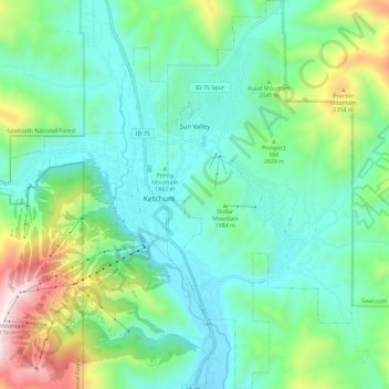
Name: Sun Valley topographic map, elevation, terrain.
Location: Sun Valley, Blaine County, Idaho, USA (43.63996 -114.36125 43.72314 -114.30661)
Average elevation: 1,988 m
Minimum elevation: 1,724 m
Maximum elevation: 2,780 m